Arab Land Initiative
Good land governance, functioning land administration, and protection of housing, land and property rights are critical for the social, economic, and environmental sustainability of the Arab region and for the realisation of the human rights of all women, men, and children.
The Arab Land Initiative was established in 2016 to catalyse such positive changes. Under the leadership of UN-Habitat and the Global Land Tool Network, the Initiative empowers regional land champions through coordination, collaboration, capacity, knowledge, and information sharing.
25 April 2024
Championing Women's Housing, Land and Property Rights in Fragile Contexts
25 March 2024
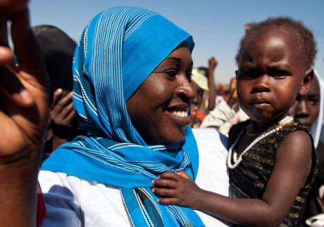
Women and land access rights in North Africa
21 March 2024
Legal, Institutional and Administrative Frameworks for Land, Housing and Property in Iraq
Publications


Events

Women and land access rights in North Africa

Climate Compass Task Force Seminar Series

UN-Habitat and GLTN to participate in the Arab Ministerial Forum on Housing and Urban Development

Workshop - Advancing women’s land rights and implementing the SDGs

The Global Refugee Forum 2023, HLP side event

Workshop on the Application of Fit-For-Purpose Land Administration in the Arab Region

World Bank Land Conference 2024! Call for papers

Page under construction!
Share with the Arab Land Initiative documents, publications and other information that can be show-cased here. Write to unhabitat-arablandinitiative@un.org

Page under construction!
Share with the Arab Land Initiative documents, publications and other information that can be show-cased here. Write to unhabitat-arablandinitiative@un.org

The island country of Comoros, or Union of Comoros, is located in the Indian Ocean at the northern end of the Mozambique Channel, off the eastern coast of Africa. Comoros has maritime borders with Tanzania, Mozambique, Madagascar, Seychelles and Mayotte (administered by France). [6] These volcanic islands form an archipelago of just over two thousand square kilometers [5] with a population of less than a million, 30 percent of which live in urban centres. The capital and largest city is Moroni on Grande Comore Island, while Anjouan Island is the most densely populated [10].

Djibouti has an are area of 23,200 km² and is home to one million people. Around 78 percent of the population lives in urban areas, with the major concentration found in Djibouti city and other nearby urban and peri-urban areas. The remaining quarter of the population lives in rural areas and it is mostly devoted to the traditional transhumant pastoralist lifestyle.[1] Traditionally, the Afar and Issa communities are camels, goats, and sheep herders. The Afar people, primarily residing in Djibouti’s northern region, are part of a larger Afar ethnic group predominantly found in Ethiopia, while the Issa people, concentrated in the southern part of Djibouti, share ethnic ties with neighbouring Somalia.[1] Power sharing struggles between the Issas and Afars led to a civil war that ravaged

Egypt is in the northeastern corner of Africa, with the Nile River valley and delta at the heart of the country, Egypt was one of the principal civilizations of the ancient Middle East.
Urbanization is a key driver of development in Egypt, 75 per cent of the GDP is generated in urban areas and 80 per cent of the jobs are in existing cities (NUP Diagnostic report, Unpublished). Urbanization in Egypt increased from 26 per cent in 1937 to 38 per cent in 1960 and 44 per cent in 1986. This percentage fell to around 42.2 per cent in 2017, not because the Egyptian urbanization rate is declining, but rather due to the lack of a clear unified definition of urban-rural areas. In 2021, 43 per cent of Egypt’s total population lived in urban areas and cities.

Iraq is one of the easternmost countries of the Arab Region. With Baghdad as its capital city, it is bordered to the north by Turkey, to the east by Iran, to the west by Syria and Jordan, and to the south by Saudi Arabia and Kuwait.
The information contained in this page gives an overview of the Iraq land sector. More detailed information, analysis, and full references can be found in the “Iraq Legislative and Administrative Land and Property Rights Framework” report developed by UN-Habitat and the Global Land Tool Network in the context of the Arab Land Initiative.

Read the newly released Jordan Land Sector Assessment!
Share with the Arab Land Initiative documents, publications and other information that can be show-cased here. Write to unhabitat-arablandinitiative@un.org

Page under construction!
Share with the Arab Land Initiative documents, publications and other information that can be show-cased here. Write to unhabitat-arablandinitiative@un.org

89 percent of the 6 million inhabitants live in urban centres, mostly along the coast. 6 percent of its 10,230 Kms surface is built-up, 32 percent is agricultural, and the remain parts are covered by grass, shrubs, rocks or forest.
Traditionally considered a middle-income country, Lebanon’s economy has been declining due to the combined effects of regional conflicts, COVID-19 pandemic, and the Beirut port explosion.
Lebanon hosts more than one million Syrian refugees scattered throughout urban and rural communities, putting additional strain on the already impoverished host communities and adding to the demand for affordable housing and basic services.

The country extends over 1,759,540 km2 where more than 90% of the total land area is desert or semi-desert. Combined with the projected increase in population, this will result in a number of major challenges in the country including the provision of adequate housing, food, clean drinking water, job opportunities, health care, education, and transportation.

Page under construction!
Share with the Arab Land Initiative documents, publications and other information that can be show-cased here. Write to unhabitat-arablandinitiative@un.org

Page under construction!
Share with the Arab Land Initiative documents, publications and other information that can be show-cased here. Write to unhabitat-arablandinitiative@un.org

The Sultanate of Oman, located on the south-eastern coast of the Arabian Peninsula, borders the United Arab Emirates, Saudi Arabia and Yemen. The country is 309,500 sq km in size, with a 2,092 km long coastline, and rugged mountains in the north and south. A vast gravel desert plain covers most of the country, which experiences sandstorms and dust storms in summer, and periodic droughts, with average precipitation of 125 mm per year.
This page presents a snapshot of Oman’s land sector. Much of its content was extracted from the report Oman Land Sector Assessment, prepared by the Urban Training and Studies Institute and the Arab Land Initiative of the Global Land Tool Network [3].

Palestine, or the Occupied Palestinian Territory (OPT), is located between the Mediterranean Sea, the Jordan River and the Dead Sea. The OPT is composed of two enclaves: the West Bank, including East Jerusalem and Gaza Strip.
The information contained in this page gives an overview of the Palestine land sector. More detailed information and analysis can be found in the “Land governance and land rights in Palestine: Analysis and recommendations” report developed by UN-Habitat and the Global Land Tool Network in the context of the Arab Land Initiative.

Page under construction!
Share with the Arab Land Initiative documents, publications and other information that can be show-cased here. Write to unhabitat-arablandinitiative@un.org
Page under construction!
Share with the Arab Land Initiative documents, publications and other information that can be show-cased here. Write to unhabitat-arablandinitiative@un.org

A repository of publications, research papers, articles, and links to relevant events by the Arab Land Initiative’s partners enriches the shared knowledge. Nine newly released documents on Somalia are now ready for download!

Situated in Northeast Africa, Sudan boasts a rich historical legacy and a diverse population estimated at 46,874,204. This vast country, covering 1.88 million km², was the largest in Africa prior to South Sudan’s secession in 2011. Khartoum, the capital, lies at the confluence of the White Nile and Blue Nile, giving birth to the iconic Nile River—the lifeblood of the region.

Officially known as the Syrian Arab Republic, Syria is inhabited by over 18 million people and it borders the Mediterranean Sea to the west, Turkey to the north, Iraq to the east and southeast, Jordan to the south, and Palestine and Lebanon to the southwest. Syria’s 185,180 square kilometers.

Tunisia is a part of the Maghreb region of North Africa, bordered by Algeria to the west and southwest, Libya to the southeast, and the Mediterranean Sea to the east and north. It contains the eastern end of the Atlas Mountains and the northern reaches of the Sahara Desert, with much of its remaining territory being arable land. Most of the southern part of the country is a sandy desert, where wadis are dry for most of the year and fresh water is scarce. Tunisia also has several islands, the Djerba Island in the Gulf of Gabès being North Africa's largest island.

Page under construction!
Share with the Arab Land Initiative documents, publications and other information that can be show-cased here. Write to unhabitat-arablandinitiative@un.org

Yemen, officially the Republic of Yemen, is a country in Western Asia, situated in the southwestern corner of the Arabian Peninsula. It borders Saudi Arabia to the north, Oman to the northeast and it shares maritime borders with Eritrea, Djibouti, and Somalia.

The University of East London (UEL) is a public university in the London Borough of Newham, London, England, based at three campuses in Stratford and Docklands, following the opening of University Square Stratford in September 2013. The university’s roots can be traced back to 1892 when the West Ham Technical Institute was established. It gained university status in 1992.
Established in 2006, the Global Land Tool Network is a coalition of over 85 international partners committed to increasing access to land and tenure security for all, with a particular focus on the poor, women and youth. GLTN partners include international rural and urban civil society organizations, research and training institutions, bilateral and multilateral organizations, and international professional bodies. Several GLTN Partners contribute to the work of the Arab Land Initiative.
The Arab Group for the Protection of Nature (APN) is an independent non-profit organization that seeks to enhance the Arab region’s sovereignty over food and natural resources, particularly in areas impacted by war, conflict and occupation. APN was established in April 2003 by a group of motivated people who aim to protect the Arab environment alongside regional and international organizations.
The Arab Group for the Protection of Nature seeks to enhance the capacity of Arab peoples, including those living under occupation and armed conflicts, to protect, sustain, and establish sovereignty over their natural resources and food, while strengthening the advocacy efforts of civil society organizations on regional and global environmental issues.
CRTEAN is a Centre for research and studies which aims at encouraging research institutions in northern African States for using remote sensing techniques and upstream systems in the areas of sustainable development and scientific research. It also encourages the transfer of technologies and Capacity building for the member states.
The signed Agreement is part of the Arab Land Initiative, under the BMZ-funded “Arab region programme on good land governance in support to inclusive development, peace and stability”. This agreement comprises an Expert Group Meeting and two trainings on fit for purpose land administration and aim in developing knowledge and capacity on fit-for-purpose land administration principles and approaches and adapt them to the countries in the Arab region.