Tunisia
Tunisia, officially the Republic of Tunisia, is the northernmost country in Africa, with a total area of 163,610 km2 and a population of 12.4 million people (in 2022), 70 per cent of which urban.
Tunisia is a part of the Maghreb region of North Africa, bordered by Algeria to the west and southwest, Libya to the southeast, and the Mediterranean Sea to the east and north. It contains the eastern end of the Atlas Mountains and the northern reaches of the Sahara Desert, with much of its remaining territory being arable land. Most of the southern part of the country is a sandy desert, where wadis are dry for most of the year and fresh water is scarce. Tunisia also has several islands, the Djerba Island in the Gulf of Gabès being North Africa's largest island.
Despite the progress made with over a century of land reforms and a recent law on land registration and land titles, there is still a lot to be done with regard to land tenure security and equal access to land in Tunisia [2]. The land and property registration system needs modernization, updating, reconciliation of private land rights recorded with different systems, and additional coverage. The rights of smallholder farmers need to be matched with mechanisms to ensure the productive use of their landholdings. Women still lag with regard to land ownership and the power to purchase land and properties. [3] State lands are important heritage, their value and productive use should be better assessed and planned. [4]
Tunisia’s ecosystems are fragile and threatened by climate change. Desertification, freshwater scarcity, reduced agricultural productivity negatively affect the socio-economic development of the country, particularly the most vulnerable, and deprive future generations of stable land tenure security and natural resources. [5] Improved land governance is necessary to balance the social, economic and environmental dimensions of land resources’ management is needed.
Land Tenure
Tunisia’s legal framework has evolved from a composition of legal traditions, including Islamic land law, colonial legislation and of modern legal texts adopted after independence (1956). According to Article 29 of the new Constitution, adopted in 2022 to replace the 2014 Constitution, “the right of ownership is guaranteed, and it shall not be interfered with except in accordance with circumstances and with protections established by the law”.
Tunisia has different types of lands.
Private land
Private land, or “melk”, constitutes 90 per cent of the arable land (approx. 47000 km2) and belongs to individuals who exercise full ownership rights. These lands include registered lands, lands subject to notary deeds, lands subject to certificates of possession, and lands with no proof of ownership. [6] Registered lands are governed by the registration system of lands and are recorded in the land registry instituted by the Land Law of July 1, 1885 and revised by the Code of Real Property Rights (law of February 12, 1965). This system defines the legal and physical consistency of the registered assets. All the land titles in the registry are available to the public. [5]
Private lands subject to notary deeds – or by private deeds signed by lawyers - compose over 40 per cent of private registered land. Notarial deeds indicate the origin of the property and the various following transactions. All acts of property sale or transfer are to be authenticated and registered at the level of the tax administration. In the early 1990s, a revision of the notary profession reinforced this system, requiring that all sales and transfers are recorded in a register, a copy of which is sent to the Ministry of Justice when it is closed.
Such a system has the advantage of providing some land tenure security at a limited cost and time investment by the owners, as it requires the involvement of a limited number of stakeholders, compared to the full private land registration system. However, its limitations are significant and include disputes due to the lack of property boundaries and the difficulty in using the notary deeds to obtain credit from the banks. Further, it is estimated that about 60 per cent of these properties do not have updated documents, as successive registrations in the event of inheritance, sale or donation have not been done. [7] It is therefore not possible to know the actual situation of these ‘frozen lands’ registered through notary deeds.
‘Frozen land titles’ are a major challenge to the functioning of the land registration system. A title is considered ‘frozen’ when the de facto status on the land does not conform to its legal status, constraining its full economic exploitation. In 1992, Law No. 92-39 established an Administrative Commission with the mandate to update such titles and, in 2021, the Real Estate Court received exclusive jurisdiction to rule on requests for the unfreezing of land titles [7] and the notary deeds system is gradually giving way to registered land. [5]
Communal land
Communal land is one of the older forms of land tenure in Tunisia. Communal – or collective - lands belong to tribes or ethnic communities [5] on the basis of undivided ownership of pastures and agricultural land. In 1901, a decree introduced the legal framework for the identification of these lands and their delimitation through local administrative committees.
Communal lands are more common in southern Tunisia, in regions where extensive itinerant livestock farming requiring frequent movements and incompatible with the individual property system are particularly widespread. [7] Nearly half of communal lands is reserved for pastures. [5]
Law No. 64-28 of 1964 explicitly recognized the right of ownership of the communities that use communal lands. Each group owning a collective land constitutes a legal person endowed with a civil personality in the acts related to the administration and the exploitation of its lands (article 4). The group is represented by a management board made up of members elected by the community and members appointed by the governor and has an advisory vote. Local (at the level of each delegation) and regional (at the level of each governorate) supervisory councils coordinate and control the management councils. [7] The management of communal lands is entrusted to the Ministry of Agriculture, which oversees on behalf of the state the dedicated regional and local institutions. [5]
The nature and way of using communal lands has been changing over the years, because of the allocation of individual plots out of communal land where some types of crops are grown (e.g. cereals). This transformed the right of collective enjoyment into individual private property. Since 1960s, communal lands nearly halved because of the effect of privatization.
State land
State lands cover an area of 8286 km2 and are managed by the Ministry of State Domains and Land Affairs since 1990. [8][9] State agricultural land belongs to the private domain of the State and represents an area of approximately 5000 km2. State lands constitute a good land reserve important for the State, although their area have reduced due to the by transfers and privatizations made since the 1970s. [5]
Habous lands
The habous is a traditional religious institution in which the owner of a land or property irrevocably assigns it for charitable use or general public interest (public Habous) or for the benefit of needy family members (private Habous) [5].Habous lands cover an area of approximately 1000 km2. [7] The habous lands were considered inalienable, imprescriptible, unseizable and, therefore, insusceptible to any transaction.
Over the years, habous lands at times experienced a loss of value, were inefficiently used, and some owners made abusive use private habous land (e.g. to benefit of male heirs and exclude female family members from inheritance). [7] Under these pretexts, public habous were incorporated into the domain of the State in 1956 and the private (and mixed) habous were abolished in 1957. These two operations led to the mobilization of several hundred million hectares. [17] In 2013, a bill to restore the habous was submitted to the National Constituent Assembly under the name of "wakf". However, the project was ultimately rejected due to a lack of consensus. [7]
Prescription
The Code of Real Property Rights governs private land ownership. Article 22 provides that “property is acquired by contract, succession, prescription, accession and by operation of law”. Article 45 states that "becomes owner by prescription, whoever exercises on a building or a real estate right, for fifteen years and as owner, a peaceful, public, continuous, uninterrupted and unequivocal possession”. However, a farmer who exercises possession of an immovable for five consecutive years in good faith, public, peaceful, continuous, uninterrupted, and unequivocal may be issued a Possession Certificate by the regional authority (according to Law No. 74-53 of 1974, as amended by Laws No. 81-13 of 1981, and No. 2000-10 of 2000). The 2000 amendment requires the farmer to undertake a project to enhance or develop the concerned land. The Possession Certificate allows the farmer to access bank financing to develop his/her agricultural activity but does not constitute a title deed and does not allow its holder to enjoy the right of ownership over the land.
The land registration system
Land registration was introduced by the Land Law of 1885, based on the Australian Torrens model, the Algerian Act of 1873, and the French Civil Code. It is now governed by the Real Property Rights Code of 1965 and Decree-Law No. 64-3 of 1964 on compulsory land registration. [7] Land registration falls under the jurisdiction of the Real Estate Court, the Department of Topography and Cartography and the Land Registrar (Conservateur). The decisions of the Real Estate Court are final and cannot be appealed. Two land registration systems are juxtaposed according to the use of the concerned land: optional registration and compulsory registration. [7]
Optional registration is governed by the Code of Real Property Rights (articles 319-357). It is initiated under referral to the Real Estate Court by the person concerned who bears the registration costs. It includes buildings not subject to compulsory registration, such as those located within municipal boundaries or in authorized rural areas. [7]
Compulsory registration, Decree-Law No. 64-3 of 1964, is initiated by an order of the Minister of Justice and conducted by the Real Estate Court at no cost to the owners. Compulsory registration is essentially aimed at the cadastral census of all unregistered rural buildings and replacing traditional title deeds with land titles. [7] The main actors of the registration systems are the Real Estate Court, the Department of Topography and Cartography, and the Registrar:
The legal pillar: Real Estate Court – Established in 1885 and renamed ‘Real Estate Court’ in 1957, it takes decisions on optional and compulsory land registrations, it updates land titles, requests revisions and rectification of decisions, and appeals against decisions of regional commissions.
The technical pillar: Department of Topography and Cartography – Under the supervision of the Ministry of Equipment, Housing and Regional Planning, it is responsible for demarcating the boundaries preparing the map of the properties to be registered. It also prepares topographic maps and plans, creates and updates the Geographic Information System and draws up land plans related to demarcations and subdivisions.
The administrative pillar: the Land Registrar – It was created in 1885, in parallel with the Real Estate Court and the Department of Topography and Cartography. In 1990, it was attached to the Ministry of State Property and Land Affairs and its role is to register properties, create and update land titles, keep records of all the instruments related to the properties registered, and record duties and charges accruing on registered properties. [5]
The main challenges of the land registration system are the high cost of property registration, the complexity and slowness of the procedures, and the weak institutional coordination. [7]
Land value
There is little published information on Tunisia’s land valuation and taxation. Taxes and fees apply, particularly during the sale and purchase. Real property transfers are subject to various registration fees (e.g. a 5 per cent transfer tax and a 1 per cent tax for unregistered buildings). [11] Owners or users of undeveloped land are subject to an annual tax. A tax of 0.2 per cent of the sales volume (with a maximum of 100,000 Tunisian dinars) must be paid on sale of industrial, commercial or professional properties. [11] Little consolidated information was found with regard to land prices, however there is a clear upward trend on prices, probably caused by both land fragmentation and land concentration for speculative purposes. [10]
Land use
Agricultural land accounts for 62 per cent Tunisia’s 164,000 km² of land, while 4.5 per cent is covered by forests and woodlands. [5] Rainfed crops represent more than 90 per cent of cultivated areas. The irrigated areas are slowly increasing, and the areas left fallow are decreasing. [14] Cultivated areas and forests have been relatively stable since 1960, but agricultural land is threatened by unregulated urban sprawl, land fragmentation, desertification, erosion, and poor soil management techniques [12], which add to the negative effects of extreme weather phenomena, particularly floods and droughts. [13]
Tunisia places significant attention on land use planning, which involves multiple actors - including ministries, public enterprises, land agencies and local communities - and addresses issues of coordination among various stakeholders’ interests and different sectoral policies. The General Directorate of Land Use Planning in the Ministry of Public Works, Housing and Land Use Planning is responsible for land use planning studies, while the Land Use Planning Inter-Ministerial Committee (CIAT) has been created to identify the possible options and ensure coordination between the main planning actors. The Ministry of Public Works, Housing and Land Use Planning is establishing a Land Use Observatory to capitalize on the data produced by various sectors and stakeholders and enable evidence-based decision making. [13]
The State aims at protecting agricultural lands through urban development plans and urban expansions planned in close coordination between the Ministries of Equipment and Agriculture. The agricultural land protection map is updated on a regular basis; it classifies agricultural lands into three categories: prohibited land (irrigated and fertile land), safeguarded land (orchards and cultivable areas), and others (e.g. cultivable land producing low yield), where urban expansion can take place. Further, the densification and high-rise housing development are encouraged to prevent further encroachment of urban land uses on agricultural land and to minimize the conflicts over land use among different land users. [15]
Urban planning has been decentralized, to give decision-making power over the allocation and use of land to local authorities (2018). The Urban Development Plans approved by the municipalities set the rules and the easements for land use [16], a good practice that faces, however, some challenges related – among others - to the complexity of the regulations and the quality of housing.
Unregulated urban expansion also affects coastal landscapes. The areas set aside for tourism are not subject to environmental protection regulations, which opens an avenue for unscrupulous actors. Saharan areas with fragile economic and social balance are also affected by touristic development that change the land ownership and land use patterns. [17]
Land development
The Ministry of Infrastructure, Housing and Territorial Development is responsible for territorial development, planning and housing policies.
Multiple ministries and institutions participate in land development, according to their areas of competence. The Housing Land Agency is responsible for acquiring and servicing land before transferring it to the citizens or developers; this intends to control prices, avoid speculation, supply sufficient social housing, and - by doing so - prevent the sprawl of self-built informal houses.
The Tourism Land Agency is responsible for acquiring and servicing lands to be used for tourism, before making it available for citizens or developers. Similarly, the Industrial Land Agency provides land services for the construction of industrial units by developers.
Local authorities are responsible for elaborating development projects at the local and regional levels. The Urban Agency of the Tunis District, for instance, elaborates a geographic database to control urban extension, monitor a set of urban indicators, and prepare land development plans for the district.
Public and private actors are encouraged to participate in land development and, since 1995, land development initiatives led by the private sector have increased.
Tunisia struggles to reconcile the need to maximise the productivity of agricultural lands and the protection of land rights of agricultural land holders. The law does not impose a floor on the agricultural area allocated to each farmer; heirs can therefore divide the lots allocated by the Agricultural Land Agency into several small or micro-plots depending on the number of heirs. This led to a trend of excessive fragmentation of agricultural land and the resulting reduced profitability and even abandonment of agricultural areas.
In the attempt to deal with the increasing land fragmentation challenges, Article 140 of the Code of Real Property Rights provides that "if there is an agricultural holding among the inheritance assets [...] constituting an economic unit, it may be attributed, by preference, to one of the heirs, taking into account the interests involved and subject to a cash payment”.
The land expropriation Law 59-48 of 1959 provides for the possibility of the expropriation by the public administrative authorities of private agricultural land considered neglected or insufficiently utilized for agricultural exploitation or conservation. According to section 3 of this law, a farm is neglected “when the usual agricultural practices have not been carried out on the property in due time during the agricultural year”. It is considered insufficiently exploited, “any land whose owner, holder or operator […] does not derive the productivity of which it would be likely because of its agricultural vocation”. However, this law is not applied.[7]
Further, Tunisia faces challenges related to land speculation, enhanced by the weakness of institutions protecting agricultural land from the expansion of unplanned settlements into farming areas. An amendment of the law to address this issue. [15]
Women and land
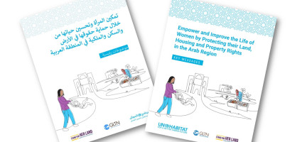
In Tunisia, the relationship between women and land reflects both progress and persistent challenges in the realm of gender equality and housing, land and property rights in the country. The importance of these rights is enshrined in the in the Tunisian constitution that recognizes the equality of women and men in duties and rights and in front of the law (art. 23), and their right to own property (art. 29) including land and housing. Tunisia has also made significant strides at the international level by ratifying the Convention on the Elimination of All Forms of Discrimination Against Women (CEDAW) without reservations, demonstrating a commitment to gender equality and the empowerment of women. Despite this progress, only 62 per cent of the women involved in a recent study carried out by UN-Habitat and GLTN, in partnership with the Union of Agricultural Working Committees, reported having full freedom to make decisions about their lives and properties. [19]
Looking at the percentages of women who own land or agricultural land in Tunisia, data remains outdated or largely unavailable. According to the latest national agricultural census (2004-2005), only 6.4 per cent agricultural land is held by women [20] and among the women who report holding some forms of rights over land, only 23 per cent possesses individual ownership rights, while 47 per cent holds customary joint ownership rights [19].
Inheritance is the primary way for both women and men to acquire land in Tunisia (90 per cent of women and 73 per cent of men). [19] This is in line with international trends and underscores the importance of familial ties and traditional practices in the distribution of land rights, and it suggests limited availability of financial resources available to women to purchase land. According to ESCWA, in 2019, only 24 per cent of women were part of the labour force, pointing to limited opportunities for women in the formal workforce. [21]
Looking into how the land is controlled and managed, the data reported by UN-Habitat [19] confirms that ownership doesn't always equate to decision-making power and financial control. Traditionally, male heads of households have been in charge of managing the land while female landowners are more likely to delegate land-related economic activities to male relatives. Within the subset of Tunisian women engaged in economic activities related to land, only 45 per cent of women lead land-related economic activities. This dynamic, however, changes in the absence of adult males in the family (i.e. widows, unmarried or divorced women) [22] underscoring once again the influence of social and family dynamics. The trend was confirmed by the outcomes of a survey rolled out in Tunisia according which most male heads of households who control land use are married, while more women gain control over the land as widows. [23]
Finally, limited awareness of housing, land and property (just 1 per cent of Tunisian women claim to have good knowledge of these rights) [19], and the systemic exclusion of women from decision-making positions further hampers tangible advancements in women's rights and empowerment in the country. To help close this gap, UN-Habitat and the Global Land Tool Network have rolled out the National Implementation of the Women and Land Campaign in Tunisia which targets a broad range of stakeholders and aims to raise awareness and initiate a multi-level dialogue on women’s right to land ownership in the country. Learn more about the campaign by visiting the campaign page.
Key interventions
In 2017, a Host Country Agreement was signed between the Government of Tunisia and UN-Habitat to establish a permanent office.
In 2018, UN-Habitat supported the municipality of Djerba Midoun in transforming an open municipal land that used to be a used as an illegal dumping site and a spot for juvenile delinquency into a safe public space with recreational and meeting facilities that enhance community cohesion, promote social interaction and inclusion, and improve the well-being of the residents. Local communities were engaged in designing the intervention and over 2,500 citizens benefit from its upgrading.
UN-Habitat supported the Tunisian Government with the development of a National Urban Policy, a common vision guiding the sustainable growth and management of cities and promoting productive, inclusive and resilient urban development. Capacity development initiatives and technical round table on data collection and monitoring supported the implementation of the policy. Local authorities and NGOs were identified and mobilized to increase the ownership of the initiatives, their success and sustainability.
References
[1] World Bank (2022). Data, Tunisia.
[2] Jouve, AM., Napoléone C. (2011). Modes de régulation de l’usage des terres en Méditerranée et protection des terres agricoles. In : Elloumi M, Jouve AM, Napoléone C, Paoli JC, eds. Régulation foncière et protection des terres agricoles en Méditerranée. Montpellier : CIHEAM, 2011. pp. 9–21 (Options Méditerranéennes : Série B. Études et Recherches, n° 66). Séminaire FONCIMED sur les modes de régulation des échanges fonciers et de l’occupation du sol, 2008/10/08-12, Antalya (Turquie)
[3] Amichi, H., Jamin, JY., & Morardet, S. (2016). Le rôle du faire-valoir indirect dans le renouvellement générationnel des agriculteurs irrigants en Tunisie
[4] Elloumi, M. (2013). Les terres domaniales en Tunisie. Études rurales 192: 43–60
[5] El-Ayachi, M., Khalil, H.A.E., Wague, O., Ganawa, E., El Azrak, S., Saidi, S., Sait, S., & Zouhiri, N. (2021). Land Tenure Systems in North Africa: A coping Study. Published by AFRICAN LAND POLICY CENTRE (ALPO) & Network of Excellence and Land Governance in Africa (NEGLA)
[6] The Tunisian legal framework of property, the occupation of the property of others and the procedures applicable thereto (2014). Report from Consulting in Community Development & Business Management. Ministry of Equipment, Regional Planning and Sustainable Development " MEDD " General Directorate for the Environment and Quality of Life (DGEQV) (PISEAU II Project)
[7] https://www.fao.org/gender-landrights-database/country-profiles/countries-list/bibliography/en/?country_iso3=TUN">FAO (2022). Gender and Land Rights Database, Tunisia
[8] Elloumi, M. (2012). Les terres domaniales en Tunisie: la longue histoire d’un accaparement foncier. Communication au colloque Territoires et patrimoines ruraux méditerranéens au XXIème siècle. Réseau EGS- Méditerranée, Marrakech, 11 – 19 octobre 2012
[9] Gharbi, M. (2002). L’intégration de l’aspect foncier dans les stratégies de la réduction de la pauvreté et le développement durable. Étude de cas: Tunisie. In Actes de l’atelier régional organisé par la Banque Mondiale (Tunis, avril 2002)
[10] Picouet, M. (2006). Dynamique des populations, disponibilités en terres et adaptation des régimes fonciers. Le cas de la Tunisie. Paris : Comité international de coopération dans les recherches nationales en démographie (CICRED)
[11] Ministry of Finances - the Republic of Tunisia (2022). General overview on Taxation
[12] Roose E, ed. (2015). Restauration de la productivité des sols tropicaux et méditerranéens. Contribution à l’agroécologie. Version préliminaire. Montpellier : IRD éditions
[13] Green Climate Fund & UNDP (2021). National Adaptation Plan: Advancing risk-informed development and land-use planning in Tunisia., Readiness Proposal
[14] de Lattre-Gasquet, M., Moreau, C., Elloumi, M., & Ben Becher, L. (2017). Towards a scenario “Agro-ecological land use for diversified and quality food and a localized food system” in Tunisia in 2050, OCL 24(3), D306
[15] Zaâbar, R. (2008). Land planning policy in Tunisia – Challenges for harmonious and integrated land planning
[16] L’ economiste Maghrebin (2021). Etude – Tunisie - l’urbanisme en difficulté
[17] Dhaher, N. (2010). L’aménagement du territoire tunisien : 50 ans de politiques à l’épreuve de la mondialisation, EchoGéo, 13 | 2010. DOI
[18] Snoussi, M. (1987). Les caractéristiques générales du régime foncier en Tunisie et quelques propositions de réformes. In Banque Mondiale, PNUD, 1987, Gestion foncière au Maroc et en Tunisie. Actes du symposium Barcelone, 22 – 25 septembre 1986, Washington
Disclaimer
The information contained in this page is based on the body of knowledge developed by UN-Habitat, GLTN and the Arab Land Initiative’s partners. The designations employed and the presentation of the material do not imply the expression of any opinion whatsoever on the part of the Secretariat of the United Nations concerning the legal status of any country, territory, city or area, or of its authorities, or concerning delimitation of its frontiers or boundaries, or regarding its economic system or degree of development. The information may contain inaccuracies due to the data source(s) and do not necessarily reflect the views of UN-Habitat or its governing bodies.
The Tunisia page is still under construction. Share with us any relevant information, resource or correction to enrich our library. Contact the Arab Land Initiative at unhabitat-arablandinitiative@un.org !
