Qatar
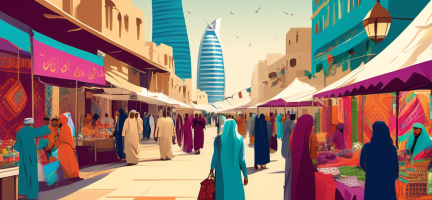
Qatar is located on a small peninsula on the northeastern coast of the Arabian Peninsula, measuring roughly 160 km north-south and 55 to 80 km east-west. It has only one land border, with Saudi Arabia, to its south. The total land area is 11,581 km2, only 5.6% of which is agricultural, with 99 per cent of the country’s total population of over 3 million (as of 2024) residing in urban areas.
Doha, its capital, has transformed from a small fishing village community to an emerging regional urban centre with more than 1.9 million inhabitants. Urban areas in the Doha region have grown at a rate of 5.45 per cent per year since 1987, increasing by 315 km2, with the peak growth period occurring between 1998 and 2003.
The country is one of the world’s wealthiest, possessing extensive oil and natural gas reserves that have driven its remarkable growth over the past few decades. Rapid changes in land use associated with economic development, climate change, urbanization, increased demand for raw materials and the need to feed a rapidly growing population are competing for use and hence good land governance is essential.
This page presents a snapshot of Qatar’s land sector. Most of its content was extracted from the report Qatar Land Sector: A Snapshot, prepared by the Urban Training and Studies Institute and the Arab Land Initiative of the Global Land Tool Network.
Legal and institutional framework
Qatar governs its land through laws, ministerial decrees and resolutions. The legal and institutional framework is grounded in Sharia law. The Permanent Constitution of the State of Qatar [2] protects land and property rights, with Article 26 stipulating that “ownership, capital and labour constitute the foundation of the social structure of the State; and the same are individual rights with a social function and which shall be regulated by the law” [2].
In 1964, Qatar passed Law No. 14 issuing the Cadastre (Land Registration) Regulation [5]. The regulation establishes the Cadastre and Documentation Department of the Ministry of Justice and sets out its responsibilities. It deals with land ownership rights, registration (including steps and fees), measures for the authentication of signatures and temporary provisions. In 1987, Qatar issued Law No. 10 on public and private State lands [6]. This law defines private State lands, concession rights, exploitation rights, ownership transfer and land leasing. It also contains provisions on offenses and penalties for contravention of the regulation.
In 1998, Law No. 13 on the expropriation of land ownership and the temporary taking of possession of lands for public utilities was passed [7]. The law primarily focuses on providing the legal framework for expropriation, including steps and measures, estimation of value, compensation and complaints. It also provides provisions related to the temporary taking possession of lands.
Through the enactment of Law No. 6 of 2014 (the “Real Estate Development Law”), the government hopes to increase investments in the real estate sector and regulate real estate developers. Prior to the Real Estate Development Law, no legislation in Qatar comprehensively addressed issues relating to the pre-construction sale of units in real estate projects. The law also sets out conditions for Qatari nationals and companies on how to conduct real estate development activities. Issued licenses are recorded on a real estate developer’s register.
The State of Qatar established the Urban Planning Authority as the body responsible for urban planning, land management and land governance. The Authority was later transformed into the Ministry of Municipality and Urban Planning. To facilitate a more integrated approach to development and the environment, particularly action on climate change, the Ministry of Municipality and Urban Planning was united with the Ministry of Environment into the new Ministry of Municipality and Environment. Within the structure of the Ministry, all urban planning tasks fall under the mandate of the Assistant Undersecretary for Urban Planning Affairs, who oversees the following technical departments: Urban Planning; Lands and Survey; Infrastructure Planning; and State Properties.
The specific responsibilities and specializations of each department complement one another, which ensures maximum oversight of the land sector and supports its role in Qatar’s development in a manner that is regulated, legitimate and sustainable.
The Urban Planning Department has the following competencies and responsibilities:
Development of urban development strategy
Preparation of planning studies and master plans
Preparation of urban, structural and general plans related to cities, urban and rural communities and villages
Preparation of detailed studies and projects for urban areas, neighbourhoods and communities
Preparation of planning criteria and regulations for all planning patterns and land uses, in coordination with the concerned authorities
Zoning to be acquired for the public interest, in line with the urban plans prepared by the Department of Land Acquisition
Establishment of an integrated database to collect, store and update planning data and information
Preparation of design rules, regulations and specifications for urban development projects
Review of the major projects’ applications and follow-up implementation procedures
Participation in the preparation of building regulations and by-laws, and proposing revisions and modernisations of such regulations
Monitoring and conducting field surveys on the urban structure of towns and urban communities
Sorting, merging and subdivision of lands and defining sites required for services and public and utilities, in coordination with the concerned authorities
Review of permanent or temporary land acquisition applications for the public interest received by the Ministry, and proposing the necessary draft legislative tools, in coordination with the concerned authorities
Implementation of permanent or temporary land acquisition applications for the public interest received by the Ministry, in coordination with the concerned authorities
Valuation of acquired properties and estimating due compensation value
Follow-up procedures for transferring ownership of acquired properties to the state
Provision of residential plots to eligible citizens, as per applicable rules and regulations
Keeping of registers for applications for housing, special offerings and Emiri grants
Payment of monetary allowance for acquisition of private lands to be integrated into the housing system
Coordination with the concerned authorities for stipulation of conditions for acquiring private lands and for lifting the on-hold condition on government lands
Establishment of a database comprising ownership particulars, land survey, update and management
Provision of the necessary data and information to the concerned authorities of the country, conducting a survey of lands and properties in all parts of the state and issuance of instructions
Inclusion of property plans on the digital map of Qatar
Inventory, survey and registration of licensed lands occupied by beneficiaries and the concerned authorities
Preparation of development plans for infrastructure, which includes water, electricity, storm water and sewage drainage, in direct coordination with the providers of these services
Monitoring procedures related to requests for road corridors planning, infrastructure networks and planning sites
Defining locations of service corridors and public utilities
Review and follow up on applications for implementation of the approved plans in urban and rural areas, in coordination with the concerned authorities
Preparation of plans, policies and development programmes for infrastructure, in coordination with the concerned authorities
Development of strategies for establishing corridors for all infrastructure facilities of the country and its components at the national level
Contributing to development of standards for the management, operation and maintenance of infrastructure services networks
Proposing policies for development of infrastructure facilities at all levels of the country, in coordination with the concerned authorities.
Maintenance of lands and state properties and the registration of all land and properties acquired for the public interest in the state properties registry
Maintenance and regulation of registries of public and private state properties
Ensuring provision of lands required for ministries, government agencies, authorities and public institutions, and recommending purchase of lands required for these authorities and housing projects
Preparation of draft sales and leases of lands and properties and following up on implementation
Safeguarding public and private state properties from encroachment and removal of the same in the event of its occurrence, in coordination with the concerned authorities
Survey and inventory of all private state properties, and registration and record-keeping in the specified register
Issuance of title deeds for non-registered government lands, as per the provisions of the real estate registration law and its executive by-laws
Management of private state properties, excluding those officially granted to a specific authority
The Land Acquisition Department has the following competencies and responsibilities:
The Department of Lands and Survey has the following competencies and responsibilities:
The Infrastructure Planning Department has the following competencies and responsibilities:
The State Properties Department has the following competencies and responsibilities:
Taking actions on non-agricultural lands, whether vacant, built or occupied with permanent or temporary structures of its occupants or others, in accordance with applicable laws.
Land tenure
In Qatar there are three primary systems for property ownership that are based on residency and nationality. The government organizes potential property purchasers into three investor categories: Qataris, GCC nationals and non-Qataris.
Until recently, two key laws formed the legal foundation of Qatar’s regime for the acquisition and registration of property [3]: Law No. 5 of 1963, which stipulated that only Qataris may own freehold estates while non-Qataris had no such right, and Law No. 14 of 1964, which created a system of registering legal instruments that affect land titles [5].
However, in 2002 Qatar passed new legislation loosening restrictions on foreign ownership of property. Nationals from the member countries of the Gulf Cooperation Council (GCC) were now permitted to own property in Qatar. GCC nationals are permitted to acquire up to three properties, subject to restrictions on their collective square meterage and provided that they are acquired for residential purposes only.
More recently, the government opened up specific areas of the real estate market to non-Qataris and non-GCC nationals (“non-Qataris”). The law now allows non-Qataris both ownership and usufruct rights in residential real estate that is located in specific investment zones, such as The Pearl and West Bay.
Land value
Land value in Qatar is one of the highest in GCC countries and the entire Arab region. In 2019, Emiri Decree No. 19 of 2019 was issued to coordinate the relationship between land value and real estate development. Following the decree, the Cabinet of Ministers established a committee for the Real Estate Development Strategy through Decision No. 10 of 2020. The objective is to promote and activate the real estate market. An essential part of the committee mandate is to conduct the needed analysis to assess the real estate promotion plan in light of the Cabinet of Ministers Decision No. 28 of 2020, which determines zones where non-Qataris can purchase and own real estate.
Qatar’s plan for integrated urban mobility, adopted as a conclusion of the Qatar National Master Plan, and the establishment of Qatar Rail (Q-Rail) resulted in an increase in land value for areas around metro stations, particularly within the city centre. More significantly, the move towards transit-oriented development in Qatar resulted in several opportunities to increase land value. As echoed in the stakeholder interviews, these include development adjacent to or integrated with the metro, mixed-use development, high-density areas and optimizing the number of regular metro users.
Land use
Just 5.6 per cent of land in Qatar is used for agriculture. This consists of permanent pasture (4.3 per cent), arable land (1.1 per cent) and permanent crops (0.2 per cent). Qatar has no forested land. The remaining 94.4 percent of the country’s land consists of built-up areas, roads and transportation infrastructure and barren lands.
A key outcome of the Qatar National Master Plan is a land-use plan for each municipality in Qatar, whereby each lot is linked to a planning zone and designated for a specific use. Furthermore, each lot is given an identification number (PIN). By entering the PIN into the Ministry of Municipality and Environment website, investors, landowners, developers and consultants can obtain all necessary technical details about a specific lot, including land use and all planning and building regulations associated with it.
Each planning zone may be listed in one or more of the three distinct groups of zoning requirements, as follows:
Group 1 – 21 separate planning zones that include various types of residential, industrial and public facilities and specified activities such as agriculture and tourism;
Group 2 – seven special planning zones that deal with development applications located within a boundary of areas of special status and sensitivity (such as heritage, coastal and airport areas); and
Group 3 – 15 zones with sets of planning and design guidelines, covering matters such as the construction of two villas on one plot of land, commercial streets guidance and interim coastal development.
Land development
The Qatar National Vision (QNV) 2030, launched in October 2008 and ratified under Emiri Decree No. 44 of 2008, aims to transform Qatar into an advanced country capable of sustaining its own development and ensuring high living standards for its people for future generations. It aims to balance present and future needs, modernization and tradition, managed growth and uncontrolled expansion, the size and quality of the expatriate labour force and the intended developmental path and economic and social development alongside environmental protection.
Based on the QNV 2030, the Ministry of Municipality and Urban Planning created a national spatial development strategy as a foundation to shape and regulate all planning and development in the country. This strategy is known as the Qatar National Development Framework. Its main pillar is sustainable development and supporting a high-quality urban lifestyle, which it aims to achieve through a number of key objectives:
Developing high-quality mixed-use, mixed-density centres as transit-oriented development;
Retaining the cultural identity of rural/non-metropolitan communities;
Establishing a high-quality and integrated public transport network;
Ensuring megaprojects and other large-scale developments are integrated into the wider community;
Promoting equitable access to public facilities and social amenities for all residents;
Developing a unique and high-quality public realm, which is equitably accessible and permeates throughout Qatar’s urban areas;
Creating high-quality residential neighbourhoods that accommodate the cultural identity and preferred lifestyles of Qataris;
Maintaining and enhancing a distinctive identity for Doha, which supports a Qatar brand;
Protecting and enhancing the natural, built and cultural environment to avoid adverse impacts from land uses;
Ensuring risks from climate change impacts are evaluated, and mitigation measures are developed and implemented for land-use planning and infrastructure development;
Establishing urban growth boundaries around Metropolitan Doha and other urban areas to ensure the efficient use and timely release of land;
Developing a plan-led system that supports and manages development change processes through appropriate institutional governance frameworks.
In light of the national vision, each governmental authority or institution was invited to create its own complementary vision. Hence, the Ministry of Municipality and Environment developed a national strategy for urban development – the Qatar National Development Framework.
Urban populations in Qatar, particularly in Doha, have seen immense growth in recent years, due in large part to both internal migration and a large influx of migrants from abroad, primarily South Asia. With such rapid urbanization, it became clear that a governing mechanism for land management and administration was needed. While a building law was issued to control the construction process, gaps at the state and municipal level remained.
The drafting and finalization of the Qatar National Master Plan, the spatial representation of the QNV 2030, was another important milestone in Qatar’s planning guidelines. It provides a clear set of plans for each of the eight municipalities. Each set includes the municipality’s vision, development strategy, land-use plan, zoning and planning regulations. The planning regulation of each municipality is certified by the Cabinet of Ministers and promulgated by an Emiri decree.
The Planning Law is a recent piece of legislation that formalizes the development planning system in Qatar. Administered by the Ministry of Municipality and Environment, the Planning Law aims to institute a clear, efficient and transparent planning system that benefits the public and private sectors and encourages responsible and sustainable development across Qatar. It establishes a legal basis for the development planning system and gives legal status to a range of planning processes, including plan-making, planning assessment, decision-making and the involvement of various stakeholders. The Planning Law consolidates all these functions into a holistic and rational planning system.
Two additional documents were drafted to introduce regulations and precisely clarify the land development mechanisms in the real estate and housing sectors. The first is the Qatar Real Estate Market Analysis study, which aims to undertake a comprehensive assessment of the current and projected future real estate stock in Qatar, including the residential, commercial/retail, office, industrial and hospitality sectors. The study analyses the gap between supply and demand in each sector of the real estate market and identifies policy recommendations to address these gaps to guide decision makers in investment projects. A main output of the study is a GIS-based application for the real estate market.
The second document is the Qatar National Housing Strategy, which sets out a plan to meet the country’s current and future housing needs. Its objective is to support the delivery of sustainable housing development while protecting the natural and historic environment for future generations. It also aims to encourage sustainable development by providing an implementation mechanism to deliver a diverse supply of housing that responds to the needs of both nationals and expats. This will allow service providers to ensure the timely provision of supporting infrastructure, services and amenities.
A third strategic study, titled Climate Change Strategy for Urban Planning and Urban Development in the State of Qatar, was conducted to address adaptation to and mitigation of climate change and to articulate a guiding principle for land development in zones along the Qatari coast that are threatened by sea level rise. Climate change poses a significant risk to Gulf countries, and the Government of Qatar thus recognizes that it is necessary to develop effective strategies and actions to mitigate climate change risks, especially since it is a signatory (or seriously considering becoming a signatory) to several global initiatives concerning climate change mitigation.
The Qatar National Master Plan, which has a horizon up to 2032, outlines all planning and development management tools for Qatar, including the Qatar National Development Framework – the principal framework for spatial planning – branding and placemaking strategies, municipal spatial development plans, action area plans for key sites such as West Bay, various Downtown Doha zones, Al-Rayyan South Metropolitan Centre, plus town centre plans for Umm Qarn, Al-Shamal and Umm Slal Mohammed. The Qatar National Master Plan is seen as crucial for reaching the government’s objectives and is the physical tool for realizing the QNV 2030. The suite of documents also includes urban design codes, design regulations, streetscape and public realm guidelines, planning standards, training and capacity building, procedures and a set of plans, including transportation, infrastructure and full GIS capability.
The Qatar National Master Plan team at the Ministry of Municipality and Environment led the production of master plans for the development of ‘centres’ across Qatar that are intended to alleviate growth pressures and address transportation problems in the country. Several new centres were identified within the framework of the Qatar National Development Framework. A hierarchy of metropolitan, town and local centres was proposed and developed in key areas around transit stations. All centre plans were based on a comprehensive planning manual that encouraged sustainable planning and design principles, such as graded density towards centres, mixed use, a permeable network of pedestrian-dominated streets and others. These principles facilitate the creation of centres that are walkable, active and complementary to its existing community. Smaller town and local centres in coastal regions of the country harnessed a number of traditional environmental principles for cooling buildings naturally by channelling the sea breeze. Islamic principles of movement were reintroduced into smaller towns to create pedestrian-only spaces, centred around the walking patterns to mosques, schools and homes.
In larger metropolitan centres, the focus lies in creating new leisure and entertainment hubs at existing areas of attraction, further enhanced by new transit stations. In addition to Education City, home to a number of educational facilities, a new residential community was designed to provide the business and residential accommodation necessary to support the growth and aspirations of the educational campus. A major new sports and entertainment district was proposed at Al-Rayyan South, to complement existing retail facilities and address problems of movement between transit stations and stadiums for the World Cup 2022. All centre plans contain the necessary tools for effective implementation, including design and land-use regulations.
According to the Real Estate Development Law No. 6 of 2014, developers are required to submit to the Department an application to create a strata title for the project being developed before units in the project can be sold on an off-plan basis. The strata title will be issued in collaboration with the Ministry of Municipality and Urban Planning. In addition, The Real Estate Department at the Ministry of Justice is to maintain an interim register for recording details of strata title.
Land dispute resolution
The mechanism to deal with disputes over land developed from an informal process conducted by tribal leaders in what is known as the Majlis – a communal space where a tribal meeting is assembled to discuss and achieve an agreement on different matters. After Qatar’s independence, a well-structured legal system was established, and several governing laws were issued to fully control land disputes.
Many of the issues surrounding land disputes in Qatar arise through real estate practices. The Ministry of Economy and Commerce established a Real Estate Dispute Resolution Committee to hear disputes arising from the Real Estate Development Law and from real estate projects. Buyers with concerns about breaches of sale and purchase agreements, project completion delays and maintenance fees can bring their grievances to the Real Estate Dispute Resolution Committee [4].
In Doha, there is also a Rental Disputes Settlement Committee Office that hears and settles rental disputes.
In 2001, Qatar was involved in a territorial dispute with Bahrain. The International Court of Justice awarded the Ḥawār Islands (just off the coast of Qatar) to Bahrain and gave Qatar sovereignty over Janān Island and the ruined fortress-town of Al-Zubārah (on the Qatari mainland). In the same year Qatar also signed a final border demarcation agreement with Saudi Arabia.
Key documents and links
[1] UN-Habitt/GLTN (2024). Qatar Land Sector: A Snapshot.
[2] Constitution of Qatar 2003.
[3] Squire Patton Boggs (2012). Qatar Law Q&A: Property Law Overview.
[4] Al Wahabi, D. and Jaffer, R. (2014). Regulating Real Estate Development in Qatar. Al Tamimi & Co.
[5] Law No. 14 of 1964 issuing the Cadastre (Land Registration) Regulation.
[6] Law No. 10 on public and private State lands.
Disclaimer
The information contained in this page is based on the body of knowledge developed by UN-Habitat, GLTN and the Arab Land Initiative’s partners. The designations employed and the presentation of the material do not imply the expression of any opinion whatsoever on the part of the Secretariat of the United Nations concerning the legal status of any country, territory, city or area, or of its authorities, or concerning delimitation of its frontiers or boundaries, or regarding its economic system or degree of development. The information may contain inaccuracies due to the data source(s) and do not necessarily reflect the views of UN-Habitat or its governing bodies.
The Qatar page is still under construction. Share with us any relevant information, resource or correction to enrich our library. Contact the Arab Land Initiative at unhabitat-arablandinitiative@un.org !
